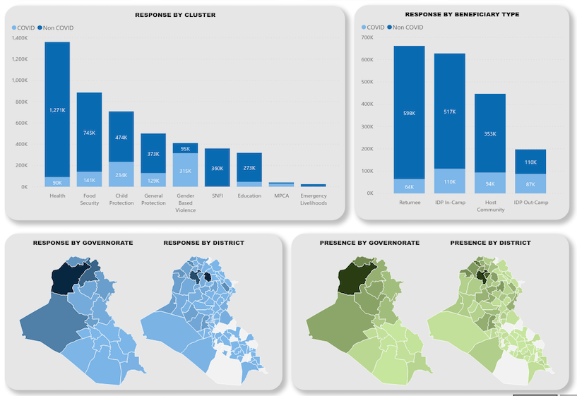
Mapping for everyone
ActivityInfo's powerful mapping tool gives everyone access to the benefits of a sophisticated Geographic Information System, without the need for extensive training.
Quick and accurate geographic overview
Use the built-in geographic database or capture specific GPS coordinates to easily display every record on its exact position on the map, by simply clicking on a button.
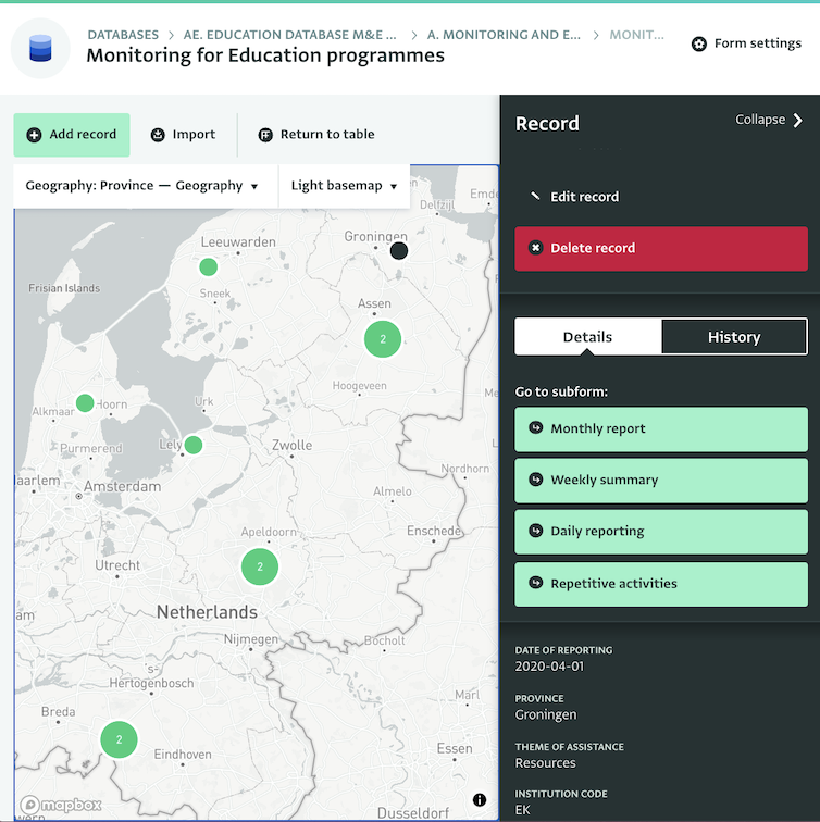
Conclusions based on real-time data
Data displayed on maps is updated as the information comes into the system, so you always get an updated overview of developments.
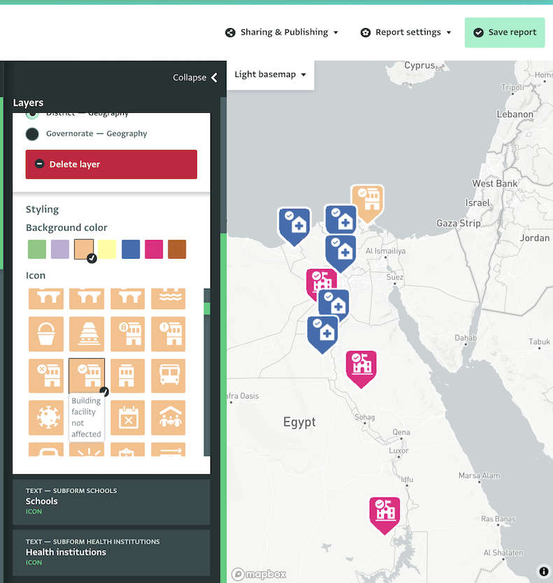
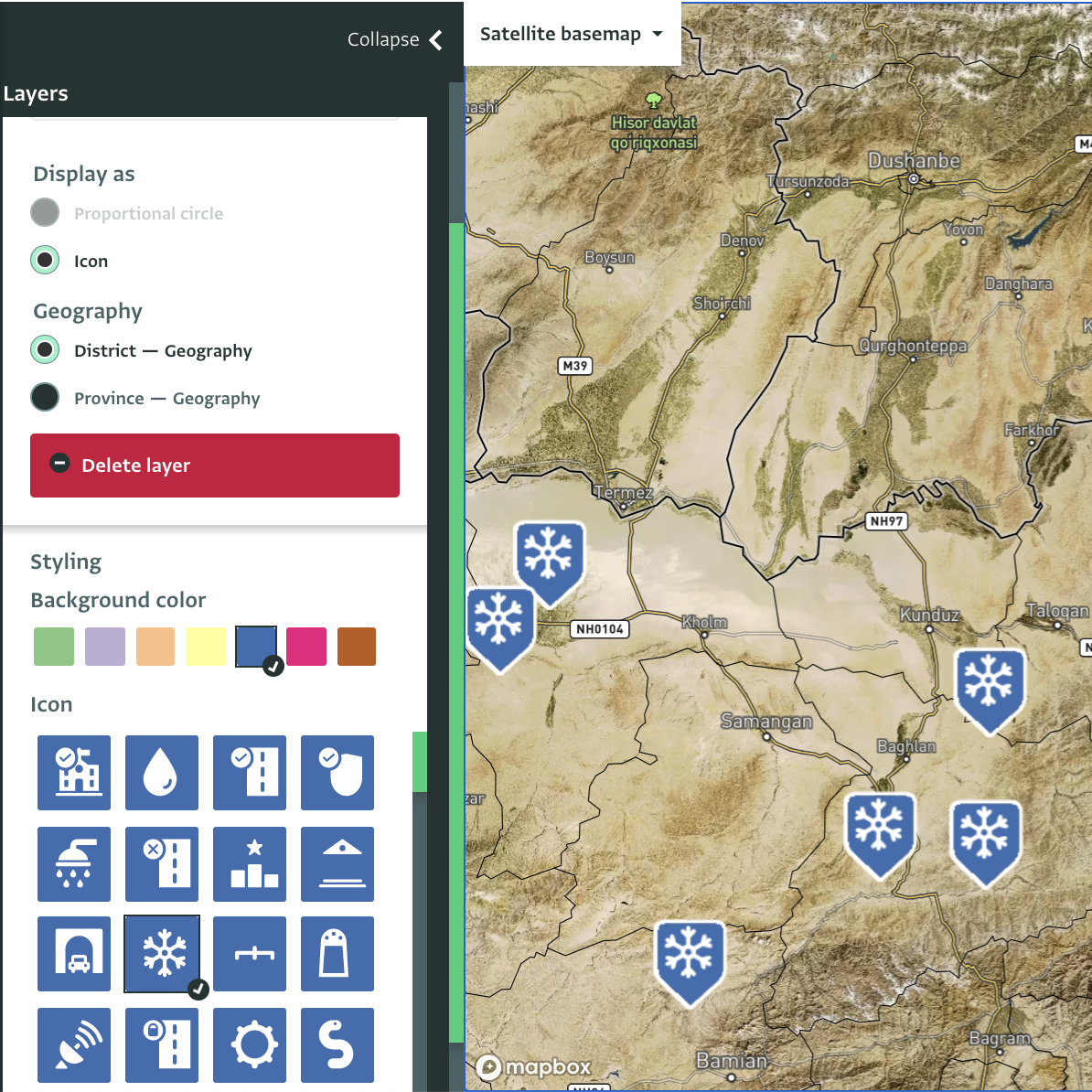
Detailed or high level information on various basemaps
Select specific records from the map to view their details or get a high level overview of all records. Select the basemap that suits your needs.
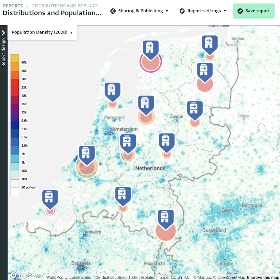
Combine your data with a world population map
Display the information you collect on a world population map for quick decision-making.
Integrations for more advanced analysis
For a more extensive selection of analysis and visualization options, ActivityInfo can be connected to external software such as Tableau and PowerBI in minutes and without any technical experience.